OOGHOOGTE (EYE LEVEL)
Commissioned by municipal Vlist
In Stolwijk, a part of the municipal Vlist, a small new urban planning project is being realised.
Stolwijk, situated at the edge of the village, borders directly on the open peatland area of the ‘Groene Hart’*.
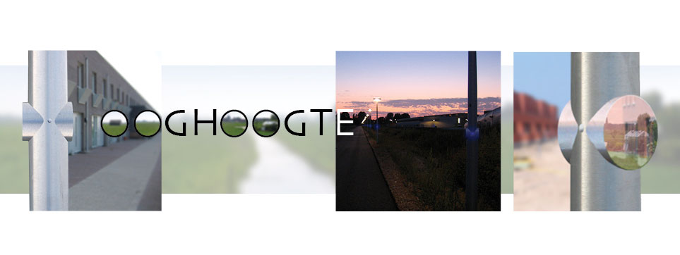
In this part of The Netherlands, the NAP** lies on +1,60 metres, nearly the same height as the general eye level.
This causes the (invisible) NAP to coincide with the (visible) horizon.
‘EYE LEVEL’ makes both points of orientation visible.
Every streetlight has small mirrors at 1.60 metres, at ‘eye level’. The mirrors reflect the image of the street, but we can also see the horizon and the open polder landscape that is located behind the houses, or do we see the landscape the way it used to be…? Is this critical commentary on the urbanization of the Groene Hart or is it a moment of poetry, a happy coincidence; “it depends on the way you look at it…”
Sketch design: 2005
* The Groene Hart is a relatively sparsely populated peatland area in the Dutch Randstad.
** NAP stands for ‘Normaal Amsterdam Peil’, or ‘Normal Level in Amsterdam’, and is the reference height used for measuring water levels.